01
Move people, not queues
Add a public transport connection that does not funnel more cars into the same motorway approaches.
An independent proposal for Tāmaki Makaurau
Before Auckland commits to another road crossing, let’s properly test a fast, resilient aerial transit connection.
The question before Auckland
The bridge matters, but congestion often continues well beyond it. A credible crossing decision must examine the whole journey, not only the water between two shores.
Add a public transport connection that does not funnel more cars into the same motorway approaches.
Give Auckland a physically separate passenger route when the bridge or its approaches are disrupted.
Meet ferries, rail, the Northern Busway, local buses, walking and cycling at useful transfer points.
One possible corridor
These locations make the idea tangible. They are not protected station sites and no land, planning, engineering or operational approval is implied. The best route may be shorter, longer or different.
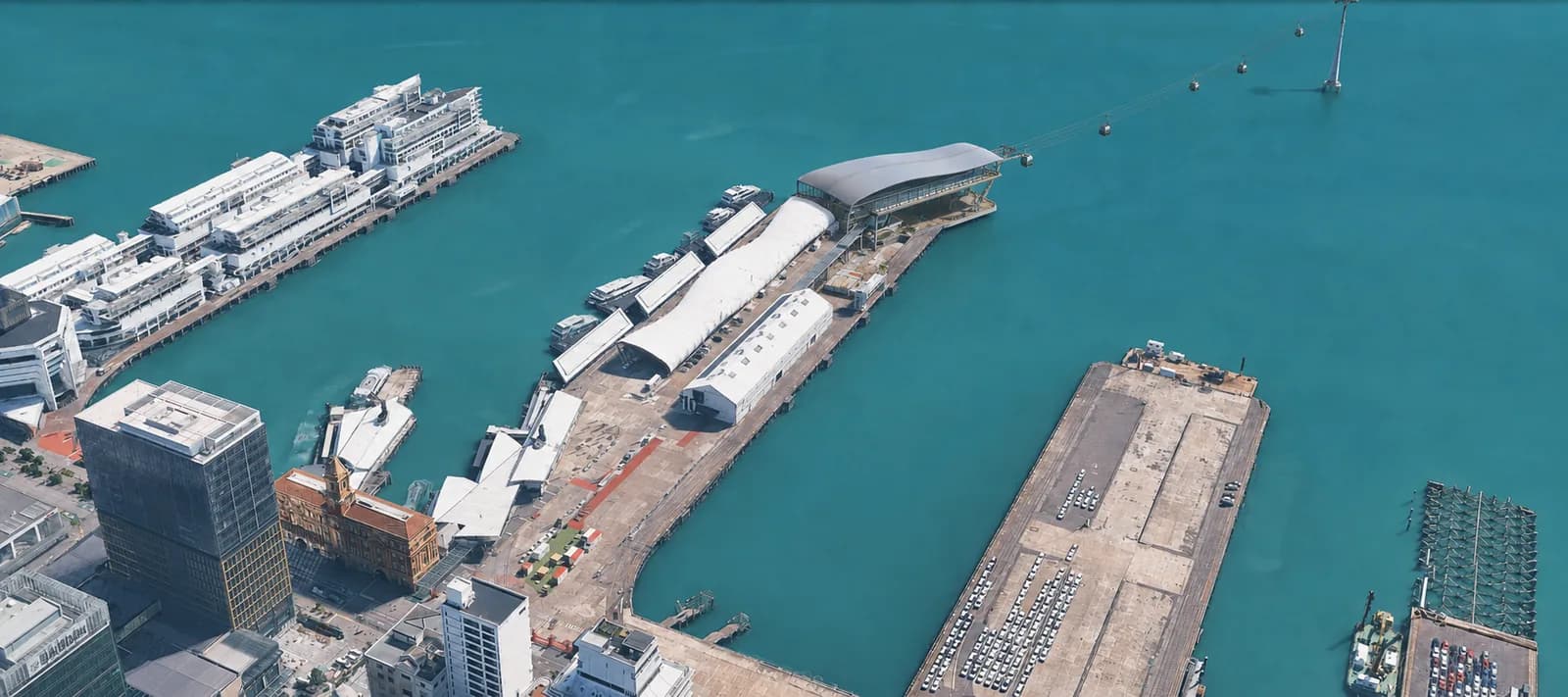
01Concept renderPossible city base station
A city gateway close to the Downtown Ferry Terminal and Waitematā Station at Britomart.
 02Concept render
Possible bus transfer station
A peninsula stop that could connect local services toward Devonport, Stanley Point and Akoranga.
 03Concept render
Possible bus transfer station
A local interchange near the Bayswater corridor, with links toward the ferry, Takapuna and Akoranga.
 04Concept render
Possible rapid transit interchange
A direct transfer opportunity with the Northern Busway and nearby education and employment areas.
 05Concept render
Possible local transfer station
A candidate local stop where feeder buses, walking and cycling access would need detailed testing.
 06Concept render
Possible northern base station
A northern hub connected to the busway, local feeder services and the wider motorway corridor.
See the terrain, station concepts, gondola movement and current alignment together.
Open the guided 3D journeyStart with scale
Observed figures describe today's harbour movement. Concept estimates describe this model. Technology benchmarks show what modern ropeways can achieve, not what this route is promised to deliver.
Current figure reported by NZ Transport Agency Waka Kotahi.
Check basisDaily bus passengers crossing the Auckland Harbour Bridge.
Check basisA communication model only. Locations and route can change.
Check basisMeasured from the present LandXML concept alignment, not a selected route.
Check basisTechnology benchmark
Up to 8,000passengers per hour, per directionDoppelmayr publishes this maximum for its current TRI-Line system, together with speeds up to 7 m/s and cabins for up to 20 passengers. Auckland's achievable capacity would depend on the selected system, stations, wind design, dwell times, demand and operating plan.
Read the supplier specificationA network of options
The existing bridge already moves a huge volume, but extra road capacity must still feed the motorway approaches at both shores.
The Northern Busway proves strong demand for shared transport. Buses remain part of the solution and could feed a gondola corridor.
Downtown ferries already connect the city with the wider region. A Queens Wharf station could make transfers part of one journey.
This is a current supplier benchmark for high capacity tricable technology, not a forecast for this Auckland concept.
Vehicle and bus figures are reported by NZ Transport Agency Waka Kotahi. Ropeway capacity is a supplier maximum. These figures use different time periods and units, so they are context rather than a like for like performance comparison.
Make transfers useful
The current concept deliberately touches existing transport corridors. Exact walking paths, bus stops, timetables, accessible transfers and station footprints would need detailed design with Auckland Transport.
Walk to downtown ferries, Waitematā Station, city buses and waterfront destinations.
Connect with local bus corridors. AT lists route 801 at Bayswater and routes 806, 807 and 814 around the Devonport peninsula.
Meet the Northern Busway and Northern Express, with local feeder services extending the reach of each station.
Safe walking, cycling, accessible access and easy interchange would be core design requirements, not optional extras.
Built for scrutiny
This project separates sourced evidence from illustrative visualisation. Traffic movement in the 3D scenes communicates patterns. It does not pretend to be a calibrated forecast.
Open sources and creditsStraight answers
This campaign is asking for disciplined investigation, not pretending the concept is already designed.
No. The six locations and current alignment make the option visible enough to discuss and test. A feasibility study must examine alternatives, land, demand, engineering, environment, cost and public input.
No. They are artistic representations showing scale and intent. Architecture, access, tower positions and station footprints are all indicative.
Not by assumption. The strongest version of the idea would connect with those modes and widen the reach of the whole public transport network.
That is a threshold question. Site-specific wind, shutdown, evacuation and rescue studies are required before any recommendation.
No. Current supplier figures show the capability range of the technology. Actual Auckland capacity and patronage would need independent engineering and demand analysis.
The approved petition can only be signed on the New Zealand Parliament website. Auckland Gondola does not collect petition signatures.
Commission and publish an independent feasibility assessment that compares aerial transit fairly with conventional crossing options.
Official petition
The petition asks for an independent feasibility study into an aerial transit crossing for the Waitematā Harbour.
Signatures are collected only on the New Zealand Parliament website. This campaign does not operate a separate petition.